This is certainly my favourite news story of the day – Google Maps and the Google World Wonders Project has started to add images of key locations in Antarctica to its collection. Someday, I hope to visit these locations myself!
Explore Scott’s Hut and the Explorers’ Heritage of Antarctica

From NBC News:
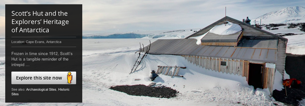
You can go inside places like polar explorer Ernest Shackleton’s hut and the other small wooden buildings that served as bases for landmark expeditions in the early 1900s. Built to withstand the drastic weather conditions for the few short years, the structures are still intact, along with well-preserved examples of the food, medicine, survival gear and equipment used during the expeditions.
You’ll also see the South Pole Telescope, the hut of Robert Falcon Scott, who led Britain’s 1901 Discovery Expedition, Cape Royds Adélie Penguin Rookery and the Ceremonial South Pole with its international flags planted in the frozen tundra.
The new photos were taken with a lightweight tripod camera using a fish-eye lens with help from the Polar Geospatial Center at the University of Minnesota and the New Zealand Antarctic Heritage Trust.
Antarctic images cater to armchair explorers – Technology & science – Science – NBCNews.com.