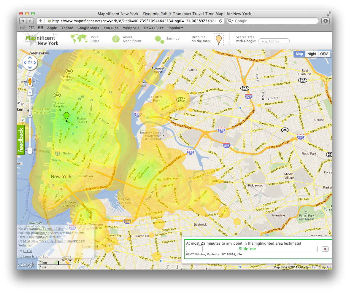
 Although not a completely new tool or concept, Mapnificent‘s method of visualizing public transportation timing and connections seems to be particularly compelling. The interface makes use of the Google Maps API, and overlays a simple set of controls to maniupulate the view of the data. Simply use a couple sliders to select your city, and how much time you have, and it will show you visually how far you can get, from a particular point. It’s interesting to see the spatial relationship of availability of public transportation with access, and definitely reinforces the concept of property being more valuable closer to public transportation. Additionally, as I tinkered with it, I found myself re-imagining my map of NYC. No longer did parts of Brooklyn and queens seem so far away, since they actually were easier and faster to get from my West Village apartment than many parts of Manhattan.

 Now, the next useful implementation of this concept would be an augmentation of the Kayak fare finder map. Kayak already has a relatively useful version of this, Kayak Explore, for finding inexpensive airfare. Put in your origin airport, and move a slider to select a budget, and the map displays possible flights for a given budge. How about mixing this with miles, and allowing a sort of maximum miles per dollar (like many of the travel hacking sites already do). What about mixing in on time percentages of flights, and other factors, to create a true recommendation of the best flight to take.
Mapnificent from Stefan Wehrmeyer on Vimeo.
“Mapnificent shows you the area you can reach with public transport from any point in a given time. It is available for major cities in the US and world wide.”